EcoFire
Predictive fire intelligence for forests.

The challenge
Frontline rangers patrol blind, because every system in disaster management detects fire after ignition. None predict it before.
FAST alerts tell you a forest is burning. Fire-prone maps tell you where fires have burned before. The entire apparatus is reactive or static.
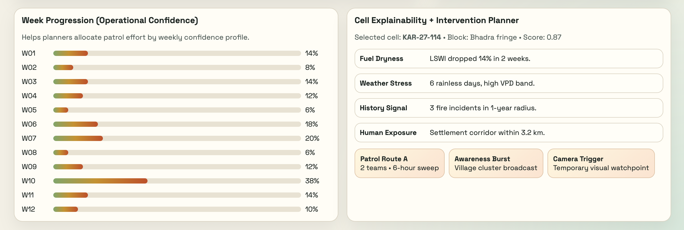
What if a forest ranger could know - a week in advance - which square kilometre to watch?
Our Approach
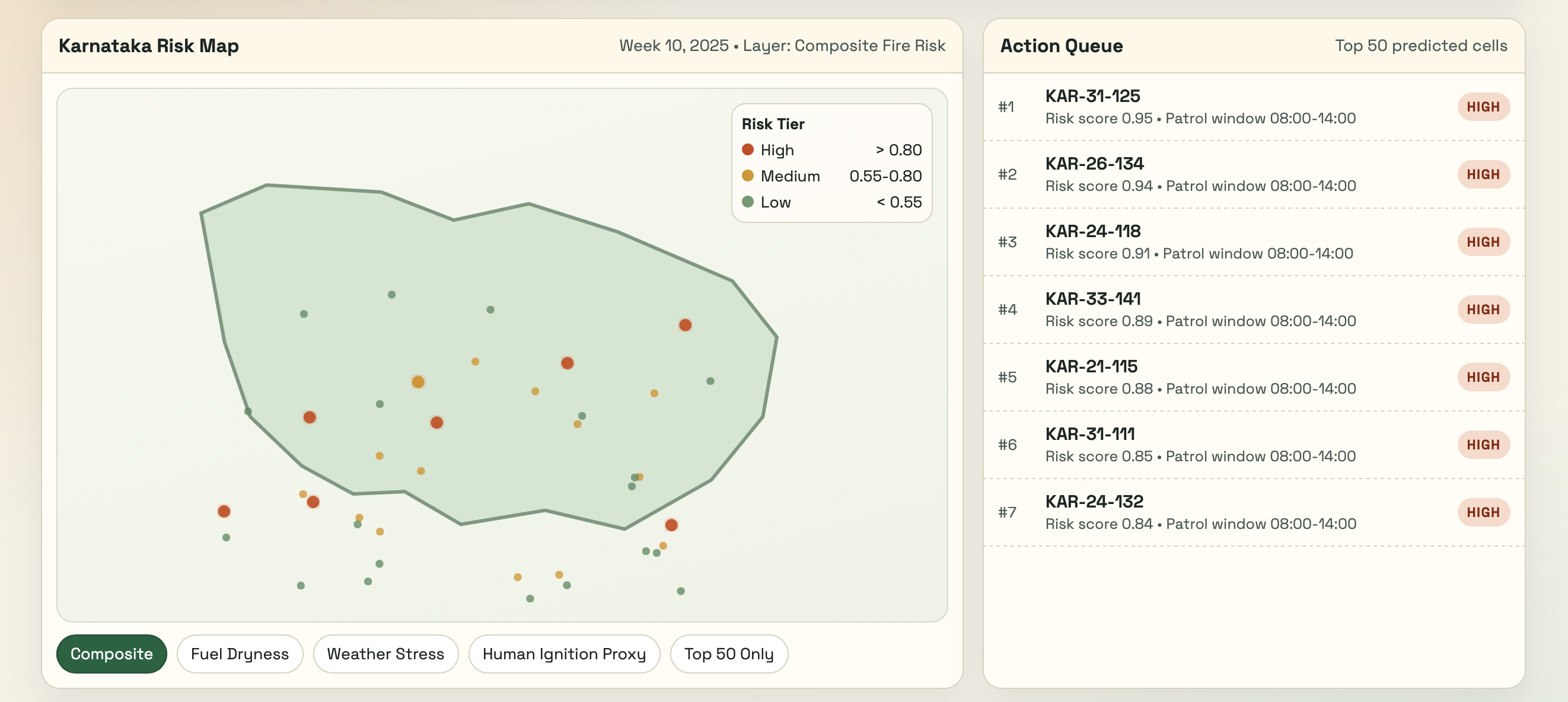
We are building a weekly fire prediction system for Indian forests. By training a model on five years of satellite data: vegetation indices, weather reanalysis, fire danger indices, terrain, soil moisture, and historical fire patterns, we are able to map 40,000 grid cells at 1km resolution across Karnataka. The model ranks every cell by fire probability each week and flags the top 50.
The Work
800× spatial reduction.
40,000 km² of forest → 50 km² shortlist. Weekly prediction.
Open and reproducible.
The full codebase, evaluation harness to be made open source, with the geospatial data lake.